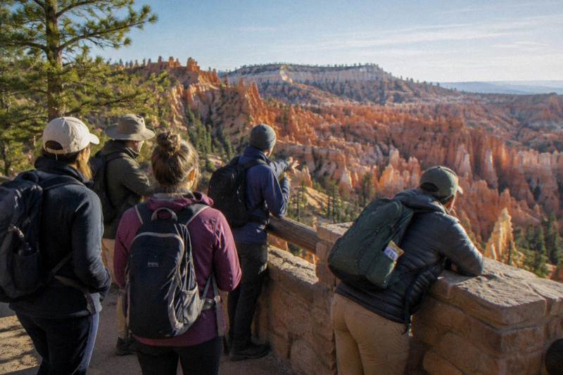
Why Are They Called Hoodoos In Bryce Canyon?
The honest answer to where the word hoodoo comes from, how Bryce Canyon's freeze-thaw climate keeps shaping the pillars, and which viewpoints and tours put you closest to them.
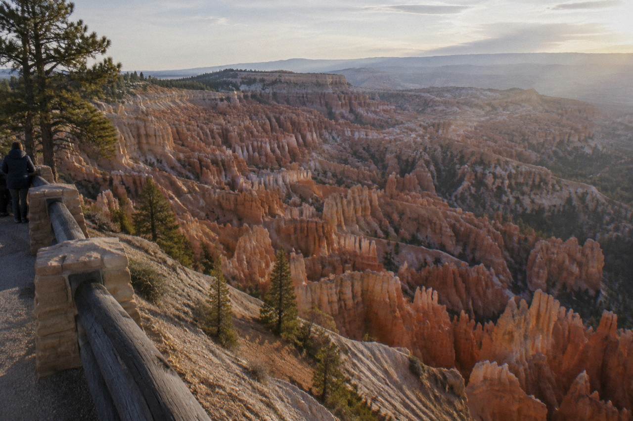
A hoodoo is a tall, narrow pillar of rock left standing after the softer stone around it has eroded away, and the word itself is simply the long-standing English name for that shape. Bryce Canyon's amphitheaters hold the largest concentration of them anywhere, which is why the park and the word have become inseparable. The name and the rock formation are worth untangling separately, because travelers often arrive expecting one story and find something more interesting: a landscape that is still actively changing, at an altitude where the weather does most of the sculpting. The park service uses "hoodoo" plainly, in signage and in ranger programs, as the working term for the pillars that fill the Bryce Amphitheater.
That is the practical answer. The richer story involves freezing nights more than three quarters of the year, a landscape measured in change rather than permanence, and a set of named formations, Thor's Hammer, Wall Street, the Cathedral, that guides on the 3-hour small group park tour point out by name on nearly every departure. This article unpacks what the word covers, what the park's own climate data says about how the pillars evolve, and where to stand to see the densest stands of them, whether you tour with a guide or drive yourself with an audio commentary running.
What Does The Word Hoodoo Actually Mean?
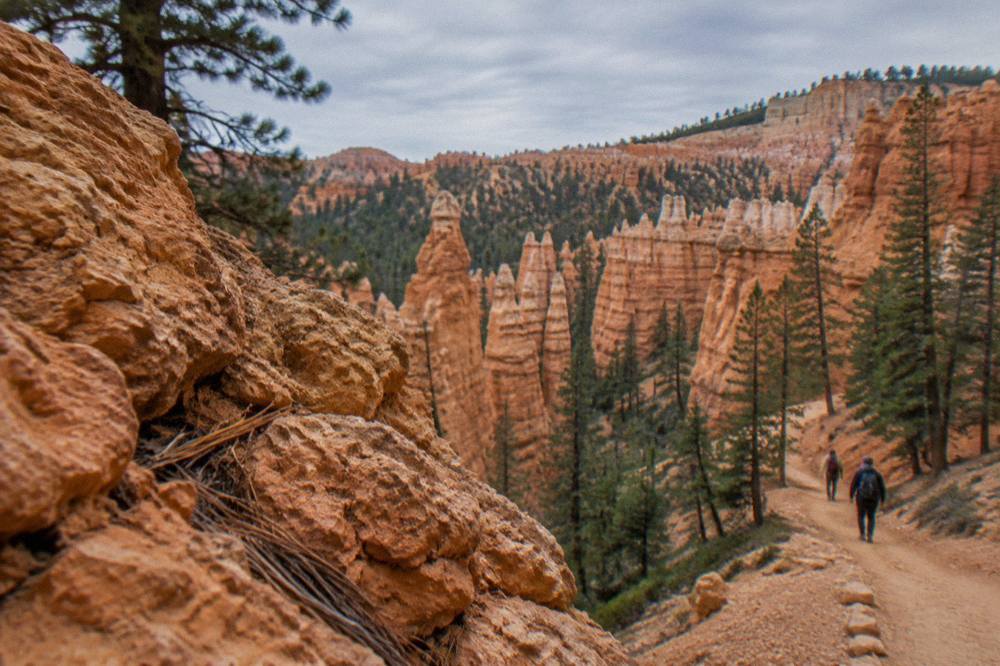
In geology, a hoodoo is a column of rock, often dozens of feet tall, that erosion has isolated from the cliff or slope it once belonged to, usually crowned by a harder cap of stone that shields the shaft below. The word is descriptive rather than technical in origin, and it is the term the National Park Service itself uses for Bryce Canyon's pillars. No single document created the name, and honest coverage stops short of inventing a tidy origin story for it. What can be said plainly is that "hoodoo" has been the accepted English label for these formations across the American West for well over a century, and that Bryce Canyon adopted it as the park's defining vocabulary.
The word carries an older, folkloric sense too, a thing or charm associated with magic and misfortune, and that older sense is part of why the name sticks in memory. Travel writers and guides have long leaned on that resonance: a landscape of thousands of silent stone figures feels named well, whatever route the word took into English. When a guide on the Scenic Tour of Bryce Canyon gestures across the Amphitheater and calls the spires hoodoos, the word is doing exactly what a name should do, giving you a handle for something you have never seen grouped so densely anywhere else.
It helps to separate three things travelers sometimes conflate. The formation type, tall eroded rock pillars, exists in other places on earth, but Bryce Canyon's concentration of them in a series of amphitheaters is what made the word and this park synonymous. The park name itself comes from Ebenezer Bryce, a settler who homesteaded in the valley, a completely separate naming story from the pillars. And the individual named formations inside the park, Thor's Hammer, the Cathedral, Wall Street, are informal names layered on top by later visitors and guides, not official survey labels. Each layer of naming answers a different question, and the hoodoo layer answers the shape question.
If you want a deeper comparison of guided options for seeing the formations, our Bryce Canyon guided tours overview breaks down what each operator includes, and the Scenic Tour of Bryce Canyon product page lists the current details for the 3-hour small group tour, from $84.81 per person, with water and snacks included and park admission separate.
How Did The Hoodoos In Bryce Canyon Form?
Bryce Canyon sits between roughly 8,000 and 9,115 feet in elevation, high enough that temperatures drop below freezing nearly every night from October through May, and that repeated freeze-thaw cycle is the engine the park service credits for the relentless sculpting of the amphitheaters. The park's own weather pages make the mechanism's scale plain: average lows sit at or below freezing from October into April, and snow is part of the landscape rather than an exception to it, with roughly 100 inches falling in an average year at park headquarters. Water that freezes in cracks overnight expands, loosens rock, and lets gravity and meltwater carry the debris away.
What makes this relevant to the name, and not just to geology, is that the pillars are not relics. The park's current conditions page reports the Wall Street section of the Navajo Loop Trail closed until further notice following heavy rains in late September 2026, a reminder that the same processes that carved the hoodoos are still actively at work on the trails between them. The Under-the-Rim backcountry route carries a standing advisory for deteriorated sections that hikers cross at their own risk. Erosion here is not a chapter that ended; it is the present tense, and the park service communicates it that way.
| Climate fact | Figure | What it means for the hoodoos |
|---|---|---|
| Park elevation range | About 8,000 to 9,115 ft | Freeze-thaw weathering operates on most nights much of the year |
| Below-freezing nights | Nearly every night, October through May | Water in rock cracks freezes and expands repeatedly each winter |
| Average annual snowfall | About 100 inches at headquarters | Meltwater adds to erosion each spring |
| Wall Street (Navajo Loop) | Closed until further notice, NPS alert of September 29, 2026 | Active rockfall and rain damage keep shaping the Amphitheater |
| Under-the-Rim Trail | Deteriorated sections, hikers at own risk | The same erosion affects backcountry routes |
The altitude matters in a second way that visitors feel directly. At 8,000 feet, the effective oxygen level is about 75 percent of what it is at sea level, which is why the park's day-hiking guidance tells visitors to drink about a quart of water every one to two hours on the trails. The hoodoos were shaped by water and ice at this altitude, and the people walking among them are breathing noticeably thinner air. Guides on full-day tour and hike options, like the small group full-day program that includes a medically trained naturalist guide, are one reason travelers hand the pacing decisions over at elevation, as our what to expect on a Bryce Canyon tour guide explains in detail.
None of this requires a geology degree to appreciate, and the best guides translate it in a sentence or two at each overlook. The Fairyland-start sightseeing tour from Bryce Canyon Scenic Tours, from $109 per person with the park entrance fee included, opens at Fairyland Canyon and works through the Natural Bridge, Inspiration Point and the Cathedral, a route that lets a guide narrate the sequence of overlooks while the story of the rock builds on itself.
Where To See The Densest Hoodoos In Bryce Canyon?
Most of the famous hoodoo views are packed into the first three miles of the park's 18-mile main road, at Bryce Point, Inspiration Point, Sunset Point and Sunrise Point, the four rim overlooks of the Bryce Amphitheater, and every guided park tour on the roster stops among them. The amphitheater is where the pillars stand densest, row after row of them below the rim, which is why first-time visitors are steered here before anything else. The park's own hiking guidance names the Queen's Garden and Navajo Loop combination, descended from Sunrise Point and climbed back to Sunset Point, as the most recommended route for first-timers who want to walk among the formations rather than look down at them.
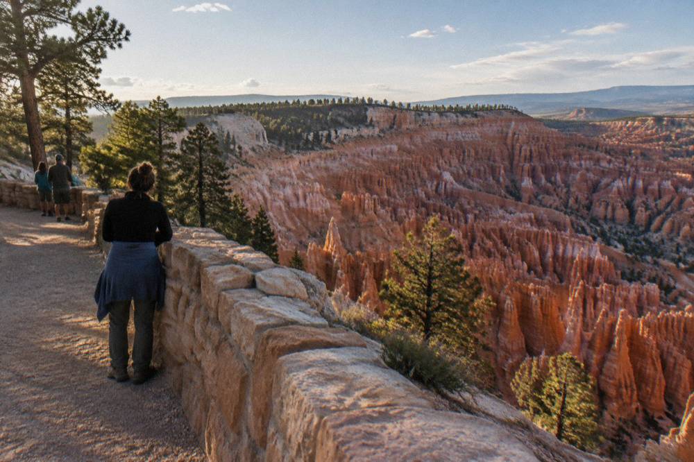
The named formations cluster in this same zone. Thor's Hammer stands below Sunset Point. Wall Street, the slot-like canyon section of the Navajo Loop flanked by towering walls, is currently closed per the park service alert, and winter closes that side of the loop seasonally regardless, so any itinerary should treat it as off the table rather than a highlight. The Cathedral and Fairyland Canyon sit at the quieter northern end, and the guided sightseeing tour that starts at Fairyland is built precisely around that less-crowded opening.
| Viewpoint or feature | Where it is | How tours reach it |
|---|---|---|
| Bryce Point | Amphitheater rim, first 3 miles | Stops on the audio driving tour, the Fairyland-start sightseeing tour and full-day hikes |
| Inspiration Point | Amphitheater rim | Included on the Fairyland-start sightseeing tour |
| Sunset Point / Sunrise Point | Amphitheater rim, trailheads for Queen's Garden and Navajo | Walking access from the shuttle and rim path |
| Fairyland Canyon | Northern end of the park road | Opening stop of the guided sightseeing tour |
| Natural Bridge | Southern scenic drive | Stop on the Fairyland-start sightseeing tour |
| Rainbow Point | Southern end, 18-mile road | Reached on full-day tour programs and by private vehicle |
Not every viewpoint requires a guide, and not every guided product stays on the rim. The self-guided driving audio tour, from $16.99 per group for up to four people in one car, uses GPS-triggered commentary that plays as you approach the Amphitheater, the Visitor Center and Bryce Point, one purchase covering everyone in the vehicle with lifetime access in the app. For travelers who prefer a live voice, the comparison between guided and self-drive approaches is laid out in Bryce Canyon tour versus self-drive, including where an audio tour genuinely matches a guide and where it does not.
The altitude shapes the viewing as much as the itinerary does. The Visitor Center itself sits at 7,894 feet, and the southern drive climbs toward 9,000-plus feet, so afternoon thunderstorms in July and August, a documented feature of the park's summer weather, can end viewpoint time abruptly. Morning visits are the standard advice from every operator on the roster, and the park service cancels ranger programs when lightning is within ten miles, a policy worth knowing if you plan your day around one.
What Is Happening To The Hoodoos Right Now?
The formations are dynamic, and the park's 2026 alerts show it: the Wall Street section of the Navajo Loop is closed until further notice after late-September rains, the Under-the-Rim backcountry trail carries a standing deterioration advisory, and winter routinely closes the Wall Street side of the loop and the Rim Trail stretch between Inspiration and Bryce Points. None of this diminishes the amphitheater views, which remain fully open from the rim overlooks, but it changes what a realistic hiking plan looks like, and it is exactly the kind of current-conditions detail that a live guide or the park's own alerts page handles better than a printed itinerary.
The closures are, in a real sense, the hoodoo story continuing in front of you. The pillars exist because rock is leaving this landscape constantly, grain by grain and slab by slab, and occasionally in larger pieces that close a trail section. The Bridge Fire of 2024, the largest fire in park history at 3,947 acres with about half inside the boundary, west of Whiteman Bench, added another layer of landscape change that returning visitors notice, and the park service directs visitors to its alerts for any affected viewpoints. A landscape this active rewards checking conditions close to your travel date rather than relying on an older trip report.
There are quieter forms of change too. The Shared Use Path, the paved Canyon2Canyon Trail connecting Red Canyon, the Visitor Center and the rim points, had its final 2.7-mile segment completed in the autumn of 2026, giving pedestrians and cyclists a car-free way to move between viewpoints. The park shuttle, free with admission and running every 15 minutes or so during the season, takes pressure off the amphitheater parking that oversize vehicles are restricted from during shuttle season. Both change how a hoodoo-viewing day is assembled, and both are newer than most guidebooks on the shelf.
Do You Need A Tour To Understand The Hoodoo Story?
No, the overlooks and the park's free ranger programs tell the story on their own, but a guide compresses it: the 3-hour small group park tours exist precisely to deliver the geology, the names and the photography angles in one circuit, and the private 3-hour version lets a family set the pace. The trade-off is straightforward. On your own, you read signage and spend your time as you like, which the self-drive itineraries in our Bryce Canyon one day itinerary make easy to plan. With a guide, someone who drives the road weekly tells you which pillar is which, why the amphitheater is where it is, and where to stand at which hour.
The roster gives you three distinct depth levels for the same story. The Scenic Tour of Bryce Canyon, 3 hours, from $84.81 per person, 4.9 across 1,215 reviews, is the volume seller that fits a half day. The Fairyland-start guided sightseeing tour, from $109 per person, 4.9 across 945 reviews, includes the park entrance fee and starts in the quietest corner before working south. The private 3-hour tour, from $159.95 per person with hotel pickup listed, 5.0 across 35 reviews, suits travelers who want questions answered rather than a script delivered. All three are operated by the same local company out of Bryce Canyon City.
| Option | Format and price | What it adds to the hoodoo story |
|---|---|---|
| Scenic Tour of Bryce Canyon | 3 hours, from $84.81 per person, 4.9 from 1,215 reviews | Guide-narrated amphitheater circuit, water and snacks included |
| Guided Sightseeing (Fairyland start) | 3 hours, from $109 per person, 4.9 from 945 reviews | Entrance fee included, opens at Fairyland Canyon, includes Natural Bridge and the Cathedral |
| Private 3-hour tour | 3 hours, from $159.95 per person, 5.0 from 35 reviews | Flexible pace, hotel pickup listed, park admission separate |
| Self-guided audio drive | 1 to 2 hours, from $16.99 per group up to 4 | GPS commentary on the Amphitheater and Bryce Point, your own car |
Guides also carry the practical layer: which restrooms are where, where the shuttle stops, why the Wall Street closure reroutes the classic loop, and how much water to carry at 8,000 feet. That is the part of a park visit that guidebooks date fastest and locals track daily, and it is the honest reason a 3-hour tour punches above its length. The stargazing sessions run by the same town's dedicated operator, from $59 per person, add a second natural story after dark, since the park holds Gold Tier International Dark Sky status and runs roughly 100 astronomy programs a year, best near the new moon, with a 4-day Astronomy Festival each summer around the June new moon.
Common Questions About Bryce Canyon Hoodoos
Why Are They Called Hoodoos In Bryce Canyon?
A hoodoo is the standard name for a tall, narrow rock pillar left standing after erosion removes the softer stone around it, and Bryce Canyon's enormous concentration of these pillars made the word and the park inseparable. The National Park Service itself uses the term for the formations filling the Bryce Amphitheater.
Are Bryce Canyon's Hoodoos Still Forming?
Yes, the processes that shaped them are active today. Temperatures fall below freezing nearly every night from October through May, and the park's current alerts, including the Wall Street closure of September 2026, show erosion actively changing trails between the formations.
Where Is The Best Place To See The Hoodoos?
The Bryce Amphitheater overlooks, Bryce Point, Inspiration Point, Sunset Point and Sunrise Point, sit within the first three miles of the main road and hold the densest stands of pillars. Every guided tour of the park stops among them.
Can You Walk Down Among The Hoodoos?
Yes. The park service recommends the Queen's Garden and Navajo Loop combination from Sunrise Point to Sunset Point for first-timers. Note the Wall Street section of the Navajo Loop is closed until further notice, and every trail returns uphill at high altitude, so carry about a quart of water per one to two hours of hiking.
Do I Need A Guide To Enjoy The Hoodoos?
No, the overlooks are free to visit with park admission and ranger programs cover the geology. A 3-hour guided park tour, from $84.81 per person, adds guide narration, named-formation orientation and local current-conditions knowledge, and a self-guided audio drive from $16.99 per group is a budget middle ground.
Why Does Bryce Canyon Have So Many Hoodoos Compared With Other Parks?
The combination of high elevation, about 8,000 to 9,115 feet, and near-nightly freezing from October through May drives intense freeze-thaw weathering, which the park credits with the relentless sculpting of its amphitheaters. The result is the densest concentration of pillars for which the park is known.
Every named spire in the amphitheater, from Thor's Hammer to the Cathedral, is a work in progress on a timescale that makes a human lifetime look like a single frame of film, and the freeze-thaw engine at Bryce Canyon National Park Tours' home park keeps running whether anyone is watching. To see how the hoodoos fit into a wider southern Utah loop, our Zion and Bryce Canyon tour comparison covers the combined itineraries that pair both parks' highlights, and the park service's own frequently asked questions page answers elevation, distance and formation questions from the primary source. The current conditions page is the authoritative read on trail closures before any hike among the pillars, and the park weather page holds the month-by-month temperature and snowfall data behind the freeze-thaw story told above.