Is The Drive From Zion To Bryce Scary?
An honest look at the 78-mile drive from Zion National Park to Bryce Canyon: what the tunnel, switchbacks and mountain roads are really like, and how to make it easier.
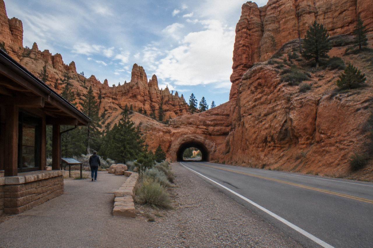
For most drivers, no. The 78 miles from Zion National Park's east entrance to Bryce Canyon run mostly on straight, well-maintained two-lane highway through open country, a distance the park service lists on its own frequently asked questions page. The part that rattles some visitors is the exit from Zion itself, with its switchbacks and the famous mile-long tunnel, a short, slow, managed stretch rather than a dangerous one.
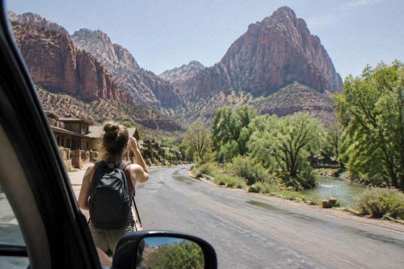
It helps to separate the drive into its two halves, because they feel nothing alike. Inside Zion, the road climbs through a series of hairpins and passes through a tunnel cut through the sandstone nearly a century ago, and the combination of tight curves and cliff walls is what fills travel forums with anxious questions. Once you are out of the canyon and on US-89 north, the character changes completely. The highway rolls across the Markagunt Plateau past ranch towns and long views, then turns onto Scenic Byway 12 for the final climb toward Bryce Canyon City. Speeds are moderate, shoulders are reasonable and traffic is light compared with the interstates most drivers are used to.
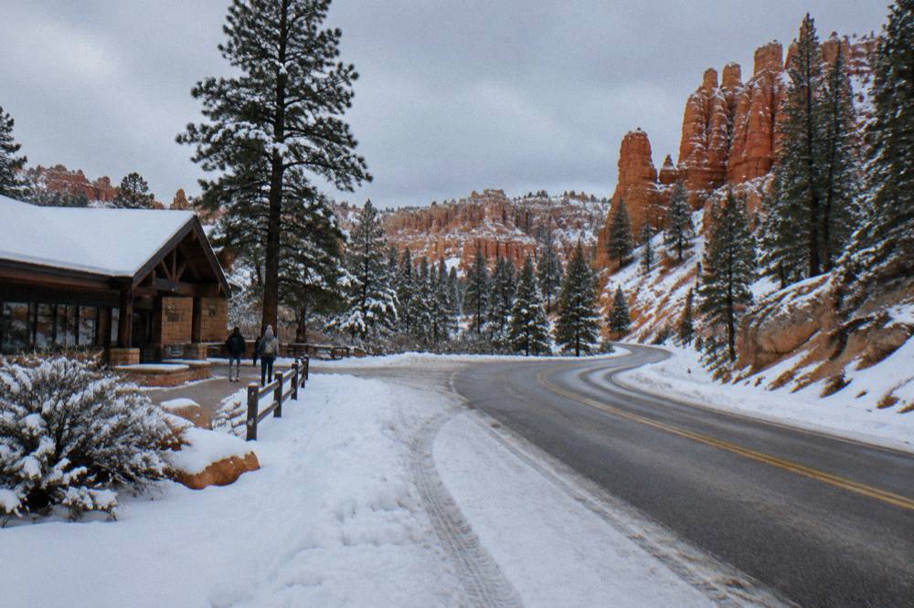
The honest answer also depends on when you make the trip. The park service notes that snowstorms are not unusual in October at Bryce's elevation, that temperatures drop below freezing nearly every night from October through May, and that winter storms can close stretches of road temporarily until plows clear them. A dry September afternoon and a January morning with packed snow are two entirely different drives on exactly the same pavement. If you are traveling in the colder half of the year, the question is less about whether the road is scary and more about whether it is temporarily closed, and the Utah traffic site and park alerts are the places to check on the day.
For travelers who would rather not drive the stretch at all, there is a middle path that removes the stress without removing the scenery. The Zion and Bryce Canyon small group tour from Marvit Tours runs the whole route in an air-conditioned vehicle with a driver and guide, from $263.99 per person, 155 reviews at 4.6, with hotel pickup and drop-off listed. And for those who enjoy driving but want the stories along the way, self-guided audio driving tours narrate the route as you go, which we will come back to below.
How Long Does The Zion To Bryce Drive Take?
The distance is about 78 miles from Zion's east entrance to Bryce Canyon, a figure the Bryce Canyon park service prints directly on its distances page, and the road routing through US-89 and Scenic Byway 12 covers modestly more once you include the climb out of the main canyon. Plan on the drive taking a good part of a morning or afternoon once you add tunnels, towns and photo stops.
The route in practice looks like this. From Springdale you climb Utah 9 through the park, pass the Zion to Mount Carmel Tunnel, and descend toward the town of Mount Carmel Junction. There you join US-89 north through Orderville and Hatch, turn east onto Scenic Byway 12 at Bryce Canyon City, and follow it a few miles to the park entrance. General mapping sources put the standard route at roughly four hours including the Las Vegas leg, but no official source publishes a drive-time figure for the Zion to Bryce segment alone, so treat any precise minute count you read online with caution. The 78-mile figure is the one grounded in the park service page.
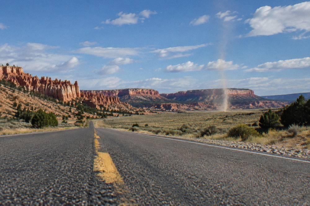
What eats time is not distance but stops. The switchbacks below the tunnel have pullouts, Red Canyon lines the final approach to Bryce with vermilion arches right beside the road, and the byway itself is one of the most photographed drives in Utah. Budget for a stop or two and the question of whether the drive is scary tends to answer itself: it is slow, deliberate and repeatedly interrupted by getting out of the car.
| Route segment | Character | What to expect |
|---|---|---|
| Zion to Mount Carmel Highway (UT-9) | Switchbacks and tunnel | Tight curves, low speeds, cliff walls, possible tunnel traffic control |
| Mount Carmel Junction to Hatch (US-89) | Open two-lane highway | Straightaways, ranch land, small towns, moderate traffic |
| Hatch to Bryce Canyon City (US-89) | Rolling plateau road | Long views, gentle grades, services in Hatch |
| Bryce Canyon City to park entrance (UT-12/63) | Forested approach | Ponderosa pines, Red Canyon just before, short final climb |
If even that sounds like more driving than you want attached to your vacation, the small group option handles it. The Marvit Tours day trip covers Zion and Bryce in 12 to 14 hours with admission fees and bottled water included, and the listing states free cancellation.
What Is The Steepest Or Tightest Part Of The Zion To Bryce Route?
The switchbacks on the Zion to Mount Carmel Highway, immediately before and after the mile-long tunnel, are the tightest and steepest part of the whole route. The road climbs out of the main canyon through hairpin turns with rock walls on one side and drop-offs on the other. Speeds drop well below highway pace, the pavement is good, and the turns are signed, which is why drivers describe it as dramatic rather than frightening.
The tunnel deserves its own sentence or two. Over a mile long and cut through the sandstone nearly a century ago, the Zion to Mount Carmel Tunnel was built for a different era of vehicles, and large vehicles are metered through it in one direction at a time during much of the year; if you are driving a recreational vehicle or towing a trailer, expect a controlled crossing and a fee. For a standard car the tunnel is simply a dark minute between two spectacular stretches of road. The park's orientation is straightforward: uphill traffic has the scenic galleries, and the descent on the east side opens into slickrock country that many visitors find the prettiest driving in Utah.
After the tunnel the answer to the scary question softens fast. The east side of Zion is wide open, and from there the road only gets calmer. The final approach through Red Canyon, where Scenic Byway 12 passes two natural arches framed by bright red hoodoo walls, is the kind of road people slow down on voluntarily. The one honest caveat is winter. The park service notes that snow can fall from October onward and that the main road at Bryce itself can close temporarily at mile marker 3 after storms until plows finish, so a storm-day drive is the one scenario where this route genuinely demands caution. For more on that side of the trip, the guide to Bryce Canyon weather by month breaks down what each season does to the roads.
Is Scenic Byway 12 Difficult To Drive?
No, and for many travelers it is the highlight of the trip. Scenic Byway 12 between US-89 and Bryce Canyon is a modern, well-surfaced two-lane road with gentle grades and none of the cliff-hugging exposure of the Zion switchbacks. Its reputation comes from beauty, not difficulty. The only conditions that change the picture are snow and ice, which the park service says can arrive as early as October at Bryce's altitude.
The byway climbs through ponderosa forest toward the Paunsaugunt Plateau, and the stretch through Red Canyon runs directly beneath sandstone arches so close to the road you can photograph them from a pullout. Grades are moderate, curves are sweeping rather than sharp, and the road is plowed and treated as a priority route in winter because it serves the towns of Tropic and Boulder beyond. If your mental image of the Zion to Bryce drive is the hairpins below the tunnel, the byway is the correction: it is the relaxing half.
One thing worth knowing as you near the park is that the area keeps improving for people who would rather not sit behind the wheel at all. The final 2.7-mile segment of the Shared Use Path was completed in autumn 2026, connecting Bryce Canyon City to the park's viewpoints with a paved trail open to pedestrians and cyclists, as announced by the park service. Between that path, the free park shuttle that runs spring through mid-October, and the guided options, a visitor can spend days here moving between hoodoo overlooks while barely touching a steering wheel.
| Concern drivers bring | What the road is actually like | Practical tip |
|---|---|---|
| Cliff-edge drop-offs | Concentrated on the Zion switchback section, not the plateau drive | Take the pullouts, drive the posted speed |
| Hairpin turns | Only on the Zion to Mount Carmel climb out of the canyon | Low gear going down, patience going up |
| Narrow tunnel | Metered for large vehicles, one-way control when needed | Cars just dim lights and proceed |
| Snow and ice | Possible from October onward; temporary closures after storms | Check park alerts and Utah traffic info same-day |
| Traffic | Light by interstate standards outside peak holiday weekends | Travel midweek in summer if flexible |
Can Someone Else Do The Driving From Zion To Bryce?
Yes, and for nervous drivers it is the single best decision of the trip. A guided small group tour runs the entire Zion to Bryce routing with a professional driver, from $263.99 per person with Marvit Tours, and multi-park day trips and multi-day tours from Las Vegas cover the same roads with pickup included. Audio driving tours offer a lighter version: you still drive, but a narrated guide handles the interpretation and pacing.
The small group tour is the fullest handoff. The listing for the Zion and Bryce Canyon small group tour includes national park admission fees, hotel pickup and drop-off, bottled water, parking fees and a driver-guide, from $263.99 per person, 155 reviews at 4.6, with free cancellation listed. One caveat for international visitors: the non-US resident fee of $100 per person for those aged 16 and over applies even inside commercial tour groups, unless covered by an America the Beautiful pass, as the park service states plainly on its fees page.
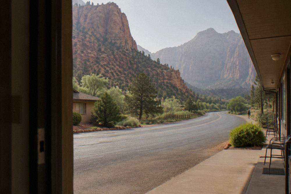
If you want to keep the rental car but lose the uncertainty, the audio options are a genuinely good fit for this specific drive. The Zion and Bryce Canyon self-driving bundle from Travel with Action costs from $24.99 per group of up to 4 and narrates both parks, with GPS-triggered stories that play automatically as you pass the tunnel, the switchbacks and the byway; the listing notes 76 reviews at 4.2 and free cancellation. The GyPSy Guide version from GuideAlong, from $26.99 per group of up to 8 with 25 reviews at 4.6, covers 195-plus points with flexible suggested routes. Neither includes a live guide, and entrance fees remain separate, the listings state. Drivers who would like a fuller comparison of every option on this road, from guided day trips to pure self-drive, will find it in what to expect on a Bryce Canyon tour.
What Time Of Year Makes The Drive Easiest?
Late spring through early fall is the easiest window. The park service says snowstorms can arrive as early as October, that freezing nights run from October to May, and that winter storms periodically close the southern scenic drive at Bryce until plowing finishes. From roughly May through September the road is typically dry, though July and August bring afternoon thunderstorms, and the park cancels ranger programs when lightning is within 10 miles.
Month by month, the pattern is clear. June, July and August are the busiest and warmest months, with average highs in the 70s to around 80 degrees Fahrenheit at Bryce's elevation, but the park service flags July and August as the rainy season with frequent afternoon storms. May, June and September hit the sweet spot of dry pavement and thinner crowds. From late October the equation changes: the shuttle season ends in mid-October, snow becomes a regular feature, and the tunnel and switchbacks, while plowed, demand real winter driving skills. Winter travelers should also know that Fairyland Point road and Paria View road close to vehicles for the season, and the Wall Street section of the Navajo Loop is closed until further notice per a park alert. The park itself never closes, it is open 24 hours a day year-round with no timed entry, as its hours page states.
| Season | Road conditions on the route | Best for |
|---|---|---|
| May to June | Typically dry, mild days, shuttle running | First-time visitors, photographers |
| July to August | Dry mornings, afternoon thunderstorms possible | Long daylight, family schedules; start early |
| September to mid-October | Usually dry, cooling nights, early snow possible | Quiet roads, fall color at elevation |
| Late October to April | Snow and ice likely at times, temporary closures after storms | Winter scenery, snowshoe and ski trips |
Elevation is the quiet factor behind all of this. Bryce Canyon sits at roughly 8,000 feet on average and reaches over 9,000 feet, per the park's own FAQ page, which is why a drive that leaves Zion warm and dry can end in snow forty minutes later in October. The guide to Bryce Canyon elevation and altitude covers what that means for drivers and hikers alike.
Tips For Drivers Who Get Nervous On Mountain Roads
Take the drive in daylight, skip the rush, and break it into stops. The scary reputation of this route comes almost entirely from the short switchback climb out of Zion, which is signed, slow and full of pullouts. Allow extra time so no turn feels pressured, check park alerts and the Utah traffic site the morning of travel, and consider handing the wheel to a guide for the day if the tunnel section is the part you dread.
A few concrete habits help. Fuel up before entering Zion, since the most convenient services sit outside the parks in Springdale, Mount Carmel Junction, Orderville and Hatch. Drive the tunnel section in the morning when traffic is lighter and the sun is not low in the west-facing curves. Use the pullouts on the switchbacks, both to let faster traffic pass and to actually look at what you just drove through. And if snow is falling or forecast, the honest move is to wait a day; the park's road closures after storms typically last a day or more while plows work, and both parks are open 24 hours, so nothing is lost by a slow morning.
Finally, remember who is publishing this advice: a site built entirely around the tours and roads of this corner of Utah, and every product named here is a real bookable listing. The stargazing sessions at Bryce Canyon City, the Red Canyon horseback ride, the helicopter flights from Bryce Canyon Airport and the 3-hour guided park tour all sit within a short drive of the road in question, which is one more reason not to treat it merely as a corridor to survive. The team behind Bryce Canyon National Park Tours covers each of them in depth. If the drive still feels like more than you want, the small group tour remains the clean answer: one booking, one driver, two parks.
Common Questions About The Zion To Bryce Drive
Is The Drive From Zion To Bryce Scary?
Not for most drivers. The only tight section is the switchback climb out of Zion on the Mount Carmel Highway, which is slow, signed and short. The rest of the 78 miles from the east entrance to Bryce run on open, well-maintained two-lane highway.
How Far Is Bryce Canyon From Zion?
By road from Zion's east entrance it is about 78 miles to Bryce Canyon, per the park service distances page. From inside Zion, the full routing through US-89 and Scenic Byway 12 adds a few more miles.
What Is The Tunnel On The Way To Bryce Canyon?
The Zion to Mount Carmel Tunnel is a mile-long tunnel through the sandstone, built for an earlier era of vehicles. Cars pass through normally, while large vehicles are metered through one direction at a time for much of the year.
Does It Snow On The Zion To Bryce Drive?
Yes, mainly at the Bryce end. The park service says snowstorms are not unusual in October, below-freezing nights run October through May, and storms can temporarily close the southern park road until plows finish.
Can I Take A Tour Instead Of Driving From Zion To Bryce?
Yes. A small group tour from Marvit Tours covers both parks from $263.99 per person with a driver-guide and admission fees, and self-guided audio tours from $24.99 per group narrate the route while you drive.
Is Scenic Byway 12 Hard To Drive?
No. The byway between US-89 and Bryce Canyon is a smooth two-lane road with gentle grades and sweeping curves. Its reputation comes from the red rock scenery of Red Canyon, not from difficulty, though winter snow changes the picture.