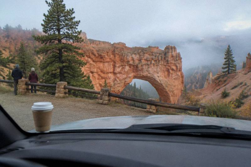
Bryce Canyon Scenic Drive Guide And Overlook Map Order
The Bryce Canyon scenic drive runs 18 miles end to end, and almost everything people picture when they picture the park sits in the first 3. Here is the overlook order, the mile markers, the winter closures, and the ways to ride the road without driving it yourself.
Short answer
The Bryce Canyon scenic drive is an 18-mile road with the four main Amphitheater viewpoints, Bryce, Inspiration, Sunset and Sunrise Points, packed into the first 3 miles. Drive it south to Rainbow Point first, then work back north so you finish with the big views. The road is open 24 hours year-round with no timed entry, and a $35 private vehicle fee applies.
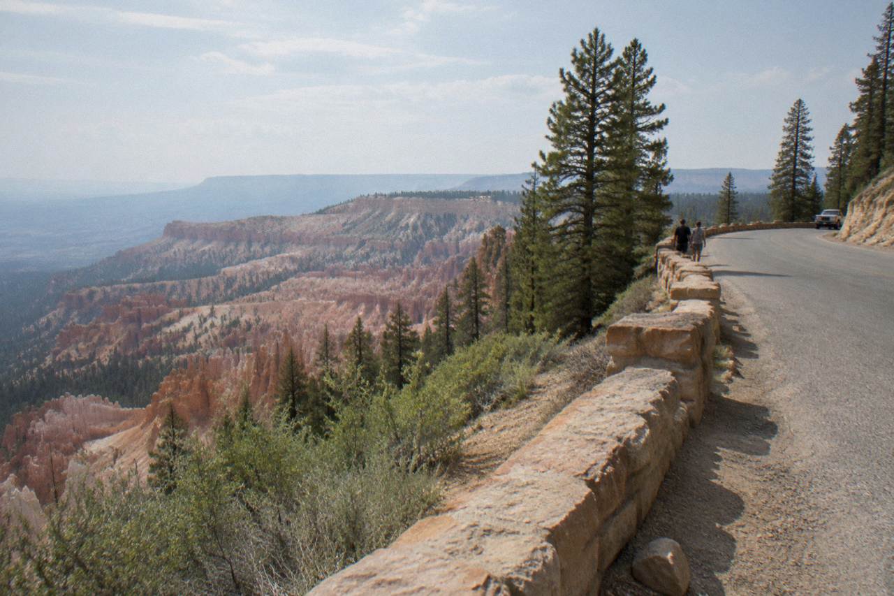
The road through Bryce Canyon National Park is 18 miles long, paved, open 24 hours a day, and remarkably front-loaded. Bryce Point, Inspiration Point, Sunset Point and Sunrise Point, the four overlooks that hold the famous Amphitheater views, all sit between mile 1 and mile 3. Everything south of that, the 15 miles running down to Rainbow Point and Yovimpa Point, is quieter, higher, and built for stops rather than hikes.
That shape decides how you should drive it. The park service itself recommends driving straight to the far end first and working back, so the trip builds toward the Amphitheater instead of peaking in the first twenty minutes. This guide walks the whole route overlook by overlook, explains what closes in winter, and covers the options for people who would rather not drive it at all: the free park shuttle, the three-hour small group park tour, and the audio driving tours that follow this exact road with GPS-triggered commentary.
Where Is The Bryce Canyon Scenic Drive And How Long Is It?
The scenic drive is an 18-mile paved road that runs the length of Bryce Canyon's rim from the entrance station at Bryce Canyon City south to Rainbow Point at 9,115 feet. It is the only road in the park, it is open 24 hours a day year-round with no timed entry or reservation, and a private vehicle pass costs $35, good for seven days. The four signature viewpoints all sit in the first 3 miles.
The road is also called the Southern Scenic Drive on some park pages, which causes confusion. In practice there is one main road: the first 3 miles hold the Amphitheater overlooks, their parking lots and the shuttle stops, and miles 4 through 18 hold the quieter southern viewpoints. U.S. Highway 63 delivers you to the entrance from the town of Bryce Canyon City, and from that gate the park road is a single out-and-back. You drive south, turn around at Rainbow Point, and drive north again.
Distances matter for planning. Zion National Park's east entrance is 78 miles away, Capitol Reef is 112, and Las Vegas and Salt Lake City airports are each about 270 miles. Nobody passes through Bryce by accident; the road is a destination, which is exactly why the overlook order question, covered next, is worth getting right before you arrive. For everything the drive does and does not replace, our Bryce Canyon tour versus self-drive comparison breaks down the trade-offs.
One more framing note. Off-highway vehicles are prohibited on every park road, and helicopters and drones may not launch or land inside the boundary. The scenic drive is cars, the park shuttle, and bicycles, nothing else. The ATV rides marketed around Bryce Canyon City run in Dixie National Forest and on private land outside the park, which is a different experience entirely.
What Overlook Order Works Best On The Bryce Canyon Drive?
Drive the full 18 miles to Rainbow Point and Yovimpa Point first, before you stop anywhere, then work back north stop by stop, finishing at the Amphitheater overlooks in the first 3 miles. This is the order the park service recommends. It guarantees you a parking spot at the small southern lots, and it saves the biggest, most crowded views for the end, when the light is often better anyway.
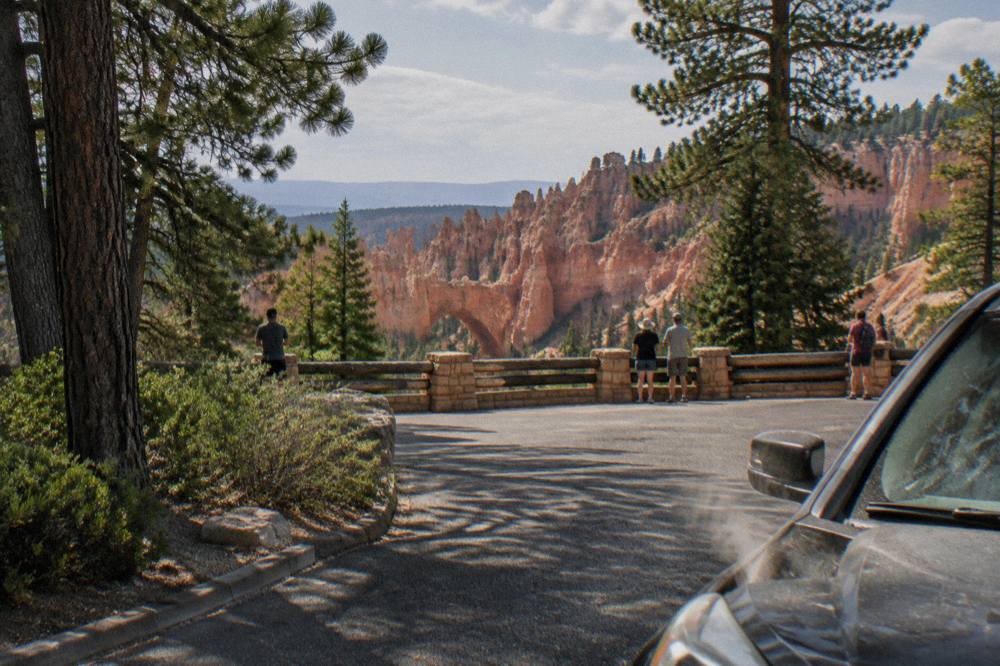
The logic is simple and practical. Rainbow Point's lot is the largest on the road, and the overlooks north of it, Natural Bridge, Agua Canyon, Ponderosa Point and the rest, have small lots that fill by mid-morning in the busy May through September season. If you tour them on the way south, you are hunting for spaces against the flow. If you run south first, you arrive at each stop heading north with the crowd already behind you.
| Order | Stop | Approximate mile | What you see |
|---|---|---|---|
| 1 | Rainbow Point and Yovimpa Point | 18 | Highest point on the road at 9,115 ft, sweeping plateau views south |
| 2 | Black Birch Canyon | 16 | Quiet canyon view, often skipped, easy pull-in |
| 3 | Ponderosa Point | 12 | Small overlook between forest and rim |
| 4 | Agua Canyon | 10 | One of the sharpest color contrasts on the southern drive |
| 5 | Natural Bridge | 9 | Drive-up view of a large natural arch, no hike |
| 6 | Farview Point | 8 | Long layered panorama across the plateau |
| 7 | Swamp Canyon | 7 | Green, wetter canyon floor, trailhead for Under-the-Rim |
| 8 | Paria View | 3.5 | Detour road, quiet, faces the sunset side |
| 9 | Bryce, Inspiration, Sunset, Sunrise Points | 1 to 3 | The Amphitheater and the park's famous hoodoo views |
Mile markers here are approximate and drawn from the park's own descriptions of the road; the park does not publish an official marker-by-marker chart, and the exact figure for any single pullout is less useful than the sequence. Two of the southern stops deserve special mention. Natural Bridge is a genuine drive-up arch, visible from the parking area with no walking, which makes it the most accessible wow on the road. Agua Canyon sits nearly 1,000 feet higher than the Visitor Center area, so it holds snow longer into spring than the Amphitheater lots do.

If you want commentary at each stop without a live guide, the self-guided audio driving tour follows this route, and the operator's listing covers it at the audio driving tour page, where a single purchase from $16.99 covers the whole car and the stories play automatically by GPS. If you would rather compare three ways to see the road before choosing, the selection below puts the audio drive against the two guided 3-hour park tours.
Which Amphitheater Viewpoints Fill The First 3 Miles Of Bryce Canyon?
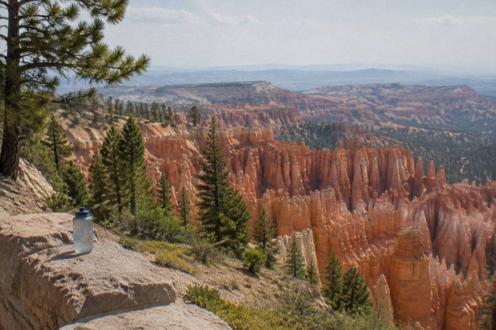
Bryce Point, Inspiration Point, Sunset Point and Sunrise Point sit between mile 1 and mile 3, and all four look into the Bryce Amphitheater, the densest collection of hoodoos anywhere in the park. Sunrise Point and Sunset Point are connected by a half-mile paved, wheelchair-accessible section of the Rim Trail, and Sunset Point is the trailhead for the Navajo Loop. Parking here is the tightest in the park.
Each of the four has a distinct character, and the differences are worth knowing before you pick where to spend your time. Sunrise Point is the gentler end, the start of the Queen's Garden trail, and the better morning light. Sunset Point fronts the tallest, sharpest hoodoo rows, including Thor's Hammer. Inspiration Point sits slightly higher and more detached, a pure viewing terrace. Bryce Point is the southern anchor of the Amphitheater, the start of the Peekaboo Loop, and the perch for the classic wide photograph.
| Viewpoint | Rim Trail connection | Trail access | Light notes |
|---|---|---|---|
| Sunrise Point | Paved half-mile to Sunset Point, wheelchair accessible | Queen's Garden trailhead | Named sunrise spot per the park service |
| Sunset Point | Paved half-mile to Sunrise Point | Navajo Loop trailhead | Afternoon sun on the hoodoo rows |
| Inspiration Point | Unpaved rim sections | Viewpoint only, no descent | Faces the main Amphitheater head-on |
| Bryce Point | Connects toward the Peekaboo Loop | Peekaboo Loop trailhead | Long views south along the rim |
One closure needs stating plainly. The Wall Street section of the Navajo Loop, the slot-canyon half of the loop below Sunset Point, is closed until further notice under a park service alert issued September 29, 2026, after heavy rains, and it closes for the winter season by default regardless. Current trail conditions are posted on the park's official conditions page. The Queen's Garden and Peekaboo Loop trails remain the recommended descents, and the park service calls the Queen's Garden and Navajo combination the best first hike in the park.
Parking is the real constraint in these 3 miles. Vehicles 23 feet and longer are restricted from Amphitheater-area parking during the shuttle season, roughly April through mid-October, though not on the southern drive beyond mile 4. In summer the honest advice is to park once, at Sunrise or Sunset, and use the Rim Trail between them rather than moving the car viewpoint to viewpoint. If you are touring the area with a guide instead, the small group 3-hour park tour from Bryce Canyon City, from $84.81 per person with 4.9 across 1,215 reviews, stops at the signature overlooks in a minivan while someone else handles the parking, and its listing shows current availability and details. Free cancellation is listed on it.
What Is On The Southern Scenic Drive Past Mile 3 At Bryce Canyon?
South of mile 3 the road climbs through quiet forest to a string of small overlooks, Farview Point, Swamp Canyon, Natural Bridge, Ponderosa Point, Agua Canyon and Black Birch Canyon, ending at Rainbow and Yovimpa Points at mile 18. Traffic thins out, lots are small, and the views shift from dense hoodoo amphitheaters to long layered distances across the Paunsaugunt Plateau.
This is the half of the road most visitors underuse. The Amphitheater holds the postcard; the southern drive holds the scale. From Farview Point the layered country runs south toward the Kaibab Plateau at the Grand Canyon's North Rim, 150 road-miles away as the park measures these things. Rainbow Point, at 9,115 feet the high point of the road, and neighboring Yovimpa Point sit above a panorama that reads more like geology textbook diagrams than close-up hoodoo forest.
Natural Bridge deserves its stop even on a tight schedule. It is one of the few major sights on the road that requires no walking at all, and it is technically an arch, carved through a fin of rock rather than by a stream, though the historic name has stuck. Agua Canyon, about 10 miles in, is the color stop: the rim rock and the hoodoo floors set the strongest contrast on the southern half, and it holds snow later in spring because of its elevation.
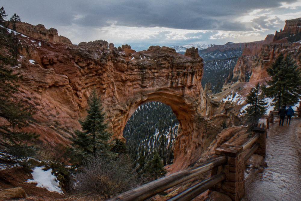
Swamp Canyon, around mile 7, is the quiet oddity. Its two small streams keep the canyon floor green and wet in a park that is otherwise dry, and it doubles as the trailhead access for the Under-the-Rim Trail, the long backcountry route. Note the park's standing advisory on that trail: it has deteriorated sections, and hikers proceed at their own risk with strong wayfinding skills. For a day visitor it is a viewpoint, not a hike.
Families and anyone short on time can compress the southern half to three stops, Farview Point, Natural Bridge and Rainbow Point, in well under an hour of driving plus photo time. If you are combining Bryce with Zion, the bundle audio tour, from $24.99 per group of up to 4 with 76 reviews at 4.2, runs the same commentary format on both park roads, and one purchase covers both drives.
When Do Roads Close At Bryce Canyon In Winter?
The park itself never closes, it is open 24 hours every day of the year, but the scenic drive can temporarily shut at mile marker 3 after winter storms so plows can clear the southern 15 miles, with closures typically lasting a day or more. The Amphitheater viewpoints in the first 3 miles are plowed first and stay the priority. Two spur roads close for the entire winter.
The two seasonal closures are Fairyland Point Road, a one-mile spur near the entrance, and the short Paria View road, a third of a mile. Both are gated when the plowing season begins and stay closed to vehicles until spring, though the park keeps them open to people on foot, skis and snowshoes, which turns both into unexpectedly good snow-season walks. The main road's mile-marker-3 gate is different: it is reactive, not seasonal, and the park service's winter page is the source to check before a cold-weather visit.
| Closure | What closes | When | Still accessible |
|---|---|---|---|
| Rainbow Gate at mile 3 | Southern 15 miles of the drive | After winter storms, typically a day or more until plowed | Amphitheater viewpoints always plowed first |
| Fairyland Point Road | 1-mile spur to Fairyland Point | All winter when snow requires plowing | On foot, skis or snowshoes |
| Paria View Road | 0.3-mile spur to Paria View | All winter when snow requires plowing | On foot, skis or snowshoes |
| Wall Street, Navajo Loop | Trail section below Sunset Point | Closed until further notice, plus winter closure by default | Check alerts before any loop hike |
Snow here is not a marginal event. The park averages roughly 100 inches a year at the headquarters area, with historical monthly averages running 17 inches in January, 18 in February and 17 in March, and October snowstorms are explicitly called not unusual on the park's weather page. Temperatures drop below freezing nearly every night from October through May. All of this shapes the touring season: the guided 3-hour park tours, the Las Vegas day trips and the shuttle all concentrate on April through October, and winter visitors are largely driving themselves, which is when the audio tour format earns its keep since the commentary does not care about the calendar.
For month-by-month planning, the Bryce Canyon weather by month guide has the full temperature and snowfall picture.
Do You Need The Shuttle At Bryce Canyon Or Can You Drive?
You can absolutely drive yourself; the shuttle is not mandatory and there is no timed entry. But the free park shuttle, included with your entrance receipt or pass, is highly recommended in the busy season, runs buses roughly every 15 minutes from April through mid-October, and serves the Amphitheater stops where parking is the scarcest. Bikes ride two to a front rack.
The 2026 shuttle schedule ran April 3 to May 8 and September 21 to October 18 from 8 a.m. to 6 p.m., and May 9 to September 20 from 8 a.m. to 8 p.m. The park lists the season as running through October 20, so treat mid-October as the practical end. Boarding is at the Shuttle Station in Bryce Canyon City, stop 1, or the Visitor Center, stop 6. No 2027 schedule has been published yet, so check before counting on it in spring. Our Bryce Canyon shuttle guide covers the stops and the bike-rack rules in detail.
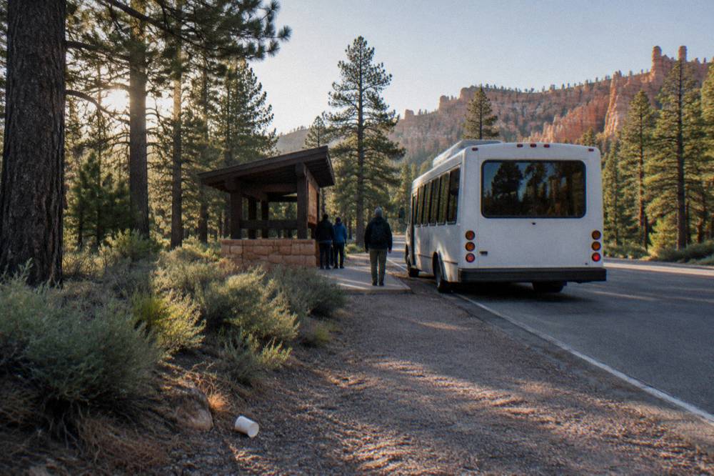
Two shuttle facts surprise people. First, the buses do not run the southern scenic drive at all; they loop the Amphitheater area and the town, so Rainbow Point and the southern overlooks are drive-it-yourself territory year-round. Second, the park's own 3-hour Rainbow Bus Tour is not being offered, and the park service instead points visitors to its approved commercial tours page for in-park transport. That is the gap private operators fill: the guided sightseeing tour from $109 per person, 4.9 across 945 reviews, includes the park entrance fee and starts in Fairyland Canyon before working down through the Natural Bridge, Inspiration Point and the Cathedral, which is essentially the southern drive in guided form.
The genuine alternative to both driving and shuttling is letting a Las Vegas day trip do the wheel work. The small group day tours from Vegas, from $219 per person for the 13-hour boutique trip with lunch, include Bryce Canyon as an itinerary stop and pair it with Zion in one long day. It is a lot of highway, about 270 miles each way, but it is the only way to see this road without a rental car.
Can You Bike Or Walk The Bryce Canyon Road?
Bicycles and low-speed pedal-assist e-bikes are allowed on park roads and on the Shared Use Path, and on nothing else; all trails and overlook paths are closed to them. The Shared Use Path, a paved route whose final 2.7-mile segment was completed in autumn 2026, now runs about 24 miles connecting Red Canyon, the Visitor Center, the Amphitheater viewpoints and Bryce Point without putting you on the road at all.
The path's completion is the biggest access change at Bryce in years. It gives cyclists, walkers and wheelchair users a car-free corridor along the rim, and it passes the campgrounds and the main viewpoints on the way. The park's news release on the Shared Use Path extension documents the final segment and the rules. Rental bikes and e-bikes are available locally in Bryce Canyon, and the park permits pedal-assist e-bikes with motors of 750 watts or less on roads and the path only.
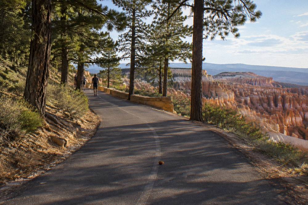
Walking the road is legal and, at the Amphitheater, what the Rim Trail already is. The paved half mile between Sunrise and Sunset Points is the accessible core, and pets are allowed on exactly that stretch, leashed at six feet or less, and on no other trail in the park. Beyond that, pedestrians share pullouts and shoulders with traffic, which is fine on the quiet southern drive and unpleasant at the busy north end in July. The altitude is the silent factor: the park averages about 8,000 feet, where effective oxygen is roughly 75 percent of sea level, and every trail here starts with a descent, which means every exit is a climb. The park advises drinking about a quart of water every one to two hours of walking.
One honest framing for the drive-it-yourself crowd: the scenic drive shows you the rim, and only the trails show you the inside. People who want both without route-finding often pair a self-driven morning with the guided hike options, or hand the whole day to the full-day small group tour and hike from $427 per person, which includes park entry fees and a naturalist guide.
Planning a full day around this road pairs naturally with a one day itinerary, and our Bryce Canyon one day itinerary sequences the drive, a hike and the shuttle into a single workable plan. For a wider view of everything bookable in and around the park, Bryce Canyon National Park Tours is the place to start.
Common Questions About The Bryce Canyon Scenic Drive
Where Is The Bryce Canyon Scenic Drive And How Long Is It?
The scenic drive is an 18-mile paved road running from the entrance at Bryce Canyon City south to Rainbow Point. It is the park's only road, open 24 hours a day year-round with no timed entry, and a private vehicle pass is $35 for seven days.
What Overlook Order Works Best On The Bryce Canyon Drive?
Drive straight to Rainbow Point and Yovimpa Point at mile 18 first, then tour the overlooks northbound, finishing at the Amphitheater viewpoints in the first 3 miles. This is the park service's recommended order and it secures parking at the small southern lots.
Can You Drive Yourself Instead Of Taking The Shuttle?
Yes. The shuttle is free with admission and recommended in the May to September season, but it is not mandatory and there is no timed entry. Note that the shuttle serves only the Amphitheater area, so the southern 15 miles of the drive are always self-drive.
Does The Scenic Drive Close In Winter?
The park stays open 24 hours all year, but after winter storms the road can temporarily close at mile marker 3 so plows can clear the southern drive, typically for a day or more. The Fairyland Point and Paria View spur roads close to vehicles for the entire winter.
Can You Bike The Bryce Canyon Scenic Drive?
Bikes and low-speed pedal-assist e-bikes are allowed on park roads and the 24-mile Shared Use Path, and on no trails. The path's final 2.7-mile segment, completed in autumn 2026, connects Red Canyon to the Bryce Point area car-free.
What Is The Best Overlook At Bryce Canyon?
There is no single official pick, but the four Amphitheater viewpoints, Sunrise, Sunset, Inspiration and Bryce Points, hold the famous hoodoo views, and the park service calls the view from Sunset and Sunrise Points the core experience. Sunrise Point is the best morning stop and Inspiration Point the purest panorama.